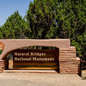
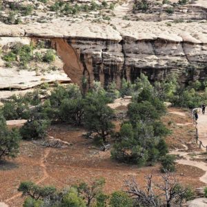
This park preserves some of nature’s most majestic, naturally occurring, stone bridges.
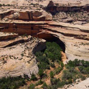
Unlike the exposed rock arches found on cliff and ridge edges, the Natural Bridges hide deep within the canyon valley. Their unusual formation takes a longer time to fully emerge, making them much rarer than the famous arches which populate nearby Arches National Park.
Human Prehistory
Although the Natural Bridges area wasn’t used for living until the Archaic[DD1] period dating from 7000 B.C to A.D. 500, the area was repeatedly occupied and abandoned during prehistoric times.
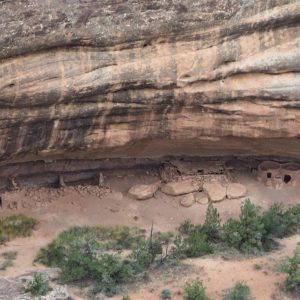
The evidence of human existence in the canyons can be seen in stone tools and rock art, suggesting early hunter-gather groups briefly populated the area. Ancestral Puebloans moved onto the mesa tops around A.D. 700. Mesa Verde farmers migrated into the area in the 1200’s. By the 1300’s, the Ancestral Puebloans had left the area and migrated south. Remains of the Ancestral Puebloans can be found in rock art and dwelling remains in the park.
Navajos and Paiutes later lived in the canyons. Navajo oral tradition stories tell that Navajo ancestors also lived among the Ancestral Puebloans.
Modern History
Three famous dates mark the Natural Bridges modern history: 1883, 1904, and 1908.
Cass Hite, a prospector in 1883, accidently stumbled upon the awe-inspiring stone bridges while searching for gold near White Canyon from his base camp along the Colorado River. In 1904, the bridges made headlines in National Geographic magazine, introducing the world to this historic landmark for the first time in modern American history. In 1908, President Theodore Roosevelt established Natural Bridges National Monument as Utah’s first National Park Service Area.
Touring the Monument
The three main sandstone bridges at Natural Bridge National Monument bear the Hopi names Sipapu, Kachina, and Owachomo. The Hopi are present-day ancestors to the Ancestral Puebloans who once lived in these canyons.
Sipapu is a word for a portal thought to be the place where their ancestors entered the present-day world. Kachina is named for rock art on one of the bridges which bears a resemblance to symbols on kachina dolls. And, Owachomo means rock mound, a feature on one of the bridges.
To tour the park by car, a scenic, 9-mile paved loop road is available which has areas for viewing. But most travelers prefer to take a short hike to a bridge viewpoint or a longer hike to a bridge for an up close and personal experience.
Sipapu is the largest and most spectacular of the bridges at a height of 220 feet and span of 268 feet across. It is considered ‘middle-aged’ among the three bridges. A 10-minute hike takes you to the Sipapu Bridge Viewpoint. The hike to the bridge takes 1 – 2 hours.
Kachina is the middle bridge in terms of its location in the park and its size (210 feet high and 204 feet across). The hike to the bridge viewpoint takes 10 minutes. A longer hike of 1- 2 hours takes you to the bridge.
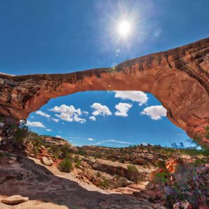
Owachoma is the smallest bridge in the park at 106 feet high and 180 feet across. It is also the oldest and the thinnest bridge. Owachoma bridge is the most accessible and most photographed bridge in the park. The 10-minute hike to the bridge viewpoint is 0.5 miles. The hike to the bridge takes 20 – 60 minutes.
World’s First International Dark Sky Park
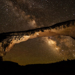
Be sure to ask about Natural Bridges Dark Sky Programs. Natural Bridges was named the world’s first international dark sky park in 2007. A dark sky means a starry sky. And in Natural Bridges, with virtually zero light pollution, a clear night results in a spectacular night sky revealing the Milky Way and millions of stars and planets.
Outdoor lighting in many metropolitan areas has virtually hidden the stars. Most people, especially those residing east of the Mississippi River, have never seen the Milky Way, or at least not as it appears from Natural Bridges.
Nearby Attractions
We recommend adding Natural Bridges National Monument to an itinerary with stops at Goosenecks State Park, Valley of the Gods, Moki Dugway and Muley Point.
General Information
Natural Bridges National Monument offers a staffed Visitor Center, picnic areas, and primitive camping.
Hours: The monument is open 24 hours a day, year-round.
The Visitor Center is open year-round, and has exhibits, a video, and bookstore. Standard hours are 9 – 5, but hours change depending on the season. Winter closure: Tuesday, Wednesday. Holiday closures: Thanksgiving, Christmas, and New Year’s Day.
Park Fees: $20 for private vehicle (15 people or less); $15 for motorcycle. National Park Passes accepted.
Camping: Camping (fee) is available in 13 designated sites near the Visitors Center. Camp sites have fire grills and picnic tables, and vault toilets, but no water, electricity or hookups. Camping is first come, first served site only. No services are available except vault toilets and trash collection.
Elevation: 6500 feet
Directions: Natural Bridges National Monument is 64 – 67 miles from Bluff depending on route.
By way of Goosenecks State Park/Valley of the Gods: Drive west from Bluff on US 191/US 163 for 20 miles, then turn north on UT-261. Continue for 33 miles. Turn left on UT-95, then right on UT 275. Follow UT-275 to park entrance.
Alternate: Drive north from Bluff on US 191 for 22 miles. Turn left on UT-95, then right on UT-275. Follow UT-275 to park entrance.
Telephone: 435-692-1234, ext. 16.


