The name “Hovenweep” is a Ute word for “deserted valley.”
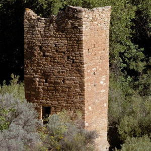
Just over 40 miles from Bluff, Hovenweep National Monument contains six prehistoric, Ancestral Puebloan villages built between 1200 and 1300. The ruins are all noted for their towers – square, oval, circular and D-shaped.
History of Hovenweep National Monument
The name “Hovenweep” is a Ute word for “deserted valley,” a well-suited description of the surrounding landscape of southeastern Utah. Once home to more than 2,500 people, inhabitants of these Ancestral Puebloan ruins are believed by archaeologists to have been farmers. Most of the buildings still standing were constructed between 1230 – 1275 CE or about the same time as nearby Mesa Verde. Evidence suggests an even earlier group of hunter-gatherers roamed the lands from 8,000 to 6,000 B.C. until about 200 A.D.
Hovenweep was first documented by W.D. Huntington during a Mormon expedition in 1854. Pioneer photographer William Henry Jackson bestowed the Ute name Hovenweep. President Warren G. Harding made Hovenweep a National Monument in 1923. Sometime in the late 1200’s A.D., the Ancestral Puebloans abandoned the region due to drought, failing crops, and possibly internal tribal conflicts. After leaving, Ancestral Puebloans settled in the Hopi mesas of Arizona and Pueblos of New Mexico.
Features
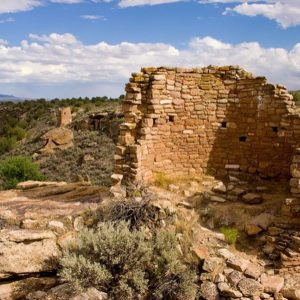
Hovenweep is unique because of the towers at each village site and masonry found throughout the monument. President Harding’s monument proclamation stated that Hovenweep had unique prehistoric structures and “the finest prehistoric masonry in the United States.” Stones were carefully shaped and smaller rocks and mortar were used to fill gaps to keep out the elements.
The towers are built at heads of small canyons near springs and seeps. Archeologists believe the towers were built at canyon heads to protect water sources needed for farming. Others believe the towers could have been used for ceremonial purposes, celestial observation, or defense.
Square Tower Group is the largest and most accessible of the six villages, and has the most well-preserved structures in Hovenweep. Think of Square Tower Group as a neighborhood of knowledgeable and savvy farmers who were able to raise enough food to sustain a sizeable population of 100 – 150 people.
The Square Tower Group contains the remains of numerous cliff dwellings, kivas, checkdams, and towers built along a small canyon known as Little Ruin Canyon. A wooden beam in one structure has a log cut in 1277 CE, one of the latest dates of any structure in the San Juan region. The sixteen room Twin Towers has among the most carefully constructed buildings in the entire southwest.
Square Tower Group can be explored via three trails: The Rim Trail Loop around Little Ruin Canyon is about 1.5 miles. The Tower Point Loop is about 0.5 miles. The Stronghold House to the Visitor Center path is about 300 yards.
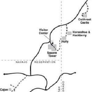
Square Tower Group was one of several other communities within a day’s walk of each other:
- Cajon Group is located at the head of Allen Canyon. This cluster of rock rooms were
constructed on a large boulder below the canyon’s rim. - Cutthroat Castle boasts unique and startling architecture that stretches below the rim of the
canyon, an outgrowth of the Hovenweep Canyon. It is the largest of these ancient remains. - Goodman Point Group plays host to a cluster of pueblo buildings that partially disappear
underground. - The Holly Group appears at the head of Keeley Canyon and is famous for what is believed
to be the summer solstice markers of rock art. - Hackberry and Horseshoe Group possess unique architectural forms, suggesting the
buildings’ features were prominent in ancient ceremonies. Stones of these buildings are set
with mortar of sand, ash, clay, and water, with a precision that still baffles modern architects.
Dark Sky Park and Stargazing
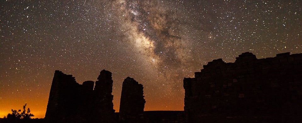
Hovenweep National Monument was designated as a Gold Tier International Dark Sky Park. You can stargaze on your own from the visitor center parking lot and campground only. Rangers present stargazing programs in spring and summer. Ancestral Puebloans were keen skywatchers. At Hovenweep, you can also learn more about the importance of celestial events in Ancestral Puebloan life.On clear nights, it is possible to spot the International Space Station at Hovenweep as it flies overhead. Check the National Park Service’s website for the next date/time of the space station flyover.
General Information
Directions: DO NOT USE GPS. Turn off US 191 just north of Bluff to UT 162 for approximately 16 miles, turn slight right and then slight left in Montezuma Creek, Utah, to continue on UT 162 for 7 miles, turn left on McElmo Canyon Road (at the park sign) for 9 miles, turn left on County Road 5099/401 for 4 miles, turn right on County Road 413/213 for 6 miles, turn right into park. (42 miles)
Hours: Open year round. Trails are open only from sunrise to sunset. Hovenweep Visitor Center is open year round. Hours may change depending on the season, staffing, and holidays.
Entrance Fees: None
Camping: Campground is open year round, on a first-come, first served basis. Fees are $15/sight from March 1 – October 31, and $10 remainder of year. The campground has 30 sites with tent pads, fire grills, picnic tables and bathrooms with running water. Hookups are not available. Campsites are designed for tent camping, although a few sites will accommodate RVs up to 36 feet long.
Pets: Pets are allowed on trails and in the campground, but must be leashed at all times.
Elevation: 5200 feet
Telephone: 970- 562-4282
Photo credits:
Square Tower; National Park Service, Neil Herbert; The Milky Way above Hovenweep Castle –National Park Service, Jacob W. Frank; Map of Hovenweep National Monument – Credit National Park Service


